Announcements
3 MIN. READ

Recently Completed Marine Gravity and Magnetics Project Sets New Record

Marine Gravity and Magnetics Project

Processed Water Depth (Left) and Processed Gravity Data (Right) Images property of and posted with permission of CGG

The world renowned data acquisition and processing teams at Xcalibur Multiphysics delivered the largest ever recorded shipborne gravity and magnetics project. The survey was acquired in conjunction with the Nebula multi-client program for CGG offshore Brazil. Over 36,700 sqkm of high resolution gravmag data were obtained in the Santos and Campos Basins with industry leading turn around time.

To date, over 100 GeoPDF GIS maps were delivered to multiple stakeholders that licensed numerous areas of interest (AOIs) over several blocks from multiple bid rounds.CGG Multi-Client New Ventures conducted the long-offset BroadSeis survey from June 2019 to January 2022. The survey is comprised of over 1,200 survey lines and 80,000 line kilometers. Along with seismic data, final products from the fully processed gravity, magnetics and bathymetry data are now available to license from CGG.

Examples of where gravity and magnetic methods can assist include: identification of salt diapirstectonics and structural mapping depth-to-basement identification of volcanics determination of sediment thickness delineation of sediment fairwaysmapping of intra-sedimentary anomalies independent geological constraints check for seismic interpretationWe are ready to illustrate how potential fields can add value to your project and enhance your exploration program.

Related news

Contact us.

FILL THE FORM
I+D
2 MIN. READ

Xcalibur Multiphysics updates MagCUBE IFR WebMap via ArcGIS Online

Xcalibur Multiphysics updates MagCUBE IFR WebMap via ArcGIS Online

Following the completion of the Xcalibur acquisition of the CGG Multi-Physics group in July 2021, we have released our updated MagCUBE In-Field Referencing (IFR) models webmap covering major shale plays throughout North America.

These IFR models for measurement while drilling (MWD) utilize both the outlines of the various shale plays (Bakken, Marcellus, Haynesville, Eagle Ford, Woodford, Niobrara, and Delaware) available via the Energy and Information Administration (EIA) that are published on ESRI’s LivingAtlas and the current Baker-Hughes Interactive Map Rig Count to delineate the extent of these pre-calculated models.The GIS team published the MagCUBE model coverage back in 2019 onto ESRI’s ArcGIS Online (AGOL) platform.

AGOL serves a large portion of the GIS community with approximately 2.1 million active users. In December of 2021, the AGOL platform shared over 48 million items which included maps, apps, and layers and had over 153 billion basemap requests, such as those accessed in the Xcalibur MagCUBE WebMap.This interactive layer allows operators and drillers to easily see if their assets intersect with the Xcalibur model coverage on their ArcGIS desktops or their online webmaps.  With MagCUBE, both onshore and offshore directional drilling projects are more accurate with reduced costs. This advanced technology is available globally, and exclusively, from Xcalibur Multiphysics.

Related news

Contact us.

FILL THE FORM
Announcements
3 MIN. READ

Explore the world with Xcalibur Multiphysics

leader in potential fields geophysics for global mineral and petroleum exploration.

We are excited to announce the new leader in potential fields geophysics for global mineral and petroleum exploration.

Formerly CGG Multi-Physics, we are delighted to now be a part of Xcalibur Multiphysics. Xcalibur group completed the acquisition of our business line at the end of Q2. This new group offers proprietary gravity, magnetic, electromagnetic and radiometric surveys with the most comprehensive range of advanced acquisition platforms in the air, on land, or at sea. Our marine group is committed to providing the same high-quality gravity and magnetic acquisition and processing services that have been recognized by the industry for over 30 years.

We have achieved a 99.9% production rate for Marine GravMag in 2020, its highest-ever score, during its acquisition of a combined total of 122,000 sail line kilometers of prime gravity and magnetic data, resulting in a record five years of sustained production rates of over 99.5%. Our leadership and commitment to QHSE ensured no injuries or incidents were recorded in 2020 and operations continued smoothly despite challenges presented by the global pandemic.

We have achieved a 99.9% production rate for Marine GravMag in 2020, its highest-ever score, during its acquisition of a combined total of 122,000 sail line kilometers of prime gravity and magnetic data, resulting in a record five years of sustained production rates of over 99.5%. Our leadership and commitment to QHSE ensured no injuries or incidents were recorded in 2020 and operations continued smoothly despite challenges presented by the global pandemic.

Xcalibur Multiphysics Marine is an ISO 9001 and OHSAS 18001-certified organization renowned for its dedication to quality, health, safety, and environmental responsibility. The highest-quality marine gravity and magnetic data is achieved through rigorous testing of equipment before and after deployment, daily evaluation of field data, use of its industry-leading LCT modeling software combined with proprietary processing techniques, and state-of-the-art in-house GIS capabilities.

Related news

Contact us.

FILL THE FORM
Announcements
3 MIN. READ

Growth in Demand for “Energy Transition Minerals” Drives Expansion for Xcalibur
Growth in Demand for Energy Transition Minerals Drives Expansion for Xcalibur

At the end of June this year, Xcalibur Airborne Geophysics completed its acquisition of all the CGG Multiphysics businesses, except the multi-client library

Minute to Read by GEO ExPro

Xcalibur has been in operation since 2002 with over 4 million line-km of data collected. It has operated successfully in most countries in Africa as well as the Middle East and Canada. The company has offices in Spain, South Africa, and Colombia and operates a fleet of aircraft which allows them to collect data in challenging environments due to their low-level flying ability and power to weight ratios.

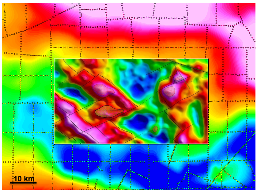
Example of Airborne Gravity Gradiometry (AGG) data used to correlate structures between seismic lines.Source: Xcalibur Multiphysics.

The new combined group will be named Xcalibur Multiphysics and will be able to offer these services on a global basis with additional offices located in North and South America, Europe, Africa, and Australia.

The enlarged company is hoping to take advantage of the projected increase in exploration activities prompted by the surge in demand for minerals resources and underground water, related to the energy transition, green energies, and sustainability challenges. They are currently also engaged in several R&D projects, including the application of Artificial Intelligence and Machine Learning in natural resources and sustainable exploration.


Related news

Contact us.

FILL THE FORM
Announcements
3 MIN. READ

Xcalibur completes the acquisition of all businesses and assets of CGG Multi-Physics

Colombia

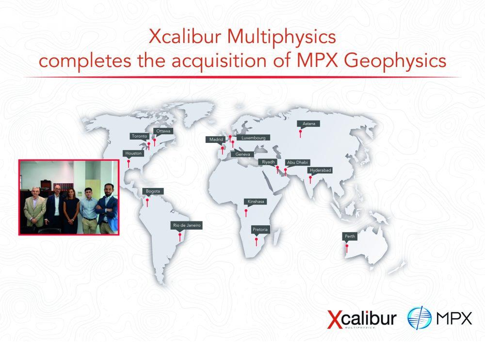
Xcalibur Airborne Geophysics is pleased to announce that it has completed the acquisition of all businesses and assets of CGG Multiphysics from the CGG group, having met all regulatory conditions.

Xcalibur completes the acquisition of all businesses and assets of CGG Multiphysics. Xcalibur is a leading provider of airborne geophysical surveys with offices in Spain, South Africa, and Colombia. Since 2002, Xcalibur has been a pioneer in the execution of low-level ultra-high resolution airborne magnetic and radiometric surveys and is an active member of the International Airborne Geophysics Safety Association (IAGSA). The company is now engaged in the execution of several large mapping projects in Africa, the Middle East, and South America. CGG Multiphysics, a business division of CGG, has been worldwide leader in Gravity Gradiometry and Electromagnetics, with offices in North America, Australia, and South America.

The new combined group will be named Xcalibur Multiphysics (xcaliburmp.com) becoming worldwide leader in provision of specialized airborne and marine geophysical services for private and government clients in the mineral, petroleum, and environmental sectors. Xcalibur Multiphysics will now be able to offer these services on a global basis with offices located in North and South America, Europe, Africa, and Australia.


Services portfolio will be the largest available in the market, using advanced technologies for Magnetics and Radiometrics, Gravity Gradiometry and conventional Gravity, and Electromagnetics, all of them supported on fixed-wing and helicopter platforms. In addition, the company will offer Marine Gravity and Magnetics, specialized Modelling software for the Oil &Gas industry, remote sensing, and data interpretation services.

Xcalibur Multiphysics will be uniquely positioned to take advantage of the projected increase in the exploration activities due to the surge in demand for minerals resources and underground water, related to the energy transition, green energies, and sustainability challenges, and will continue with its commitment to innovation with several major R&D projects being undertaken including applications of Artificial Intelligence and Machine Learning in natural resources sustainable exploration.

Related news

Contact us.

FILL THE FORM
Announcements
2 MIN. READ

Xcalibur announces the signature of an agreement for the buyout of CGGs Multi-Physics acquisition business

Xcalibur announces the signature of an agreement for the buyout of CGGs Multi-Physics acquisition business

We are glad to announce that we have entered into a Sale and Purchase Agreement (SPA) with CGG for the buyout of CGG’s Multi-Physics business.

Xcalibur announces acquisition of CGG’s Multi-Physics business. The SPA provides for the buyout of CGG’s entire Multi-Physics business, except its multi-client library, and is subject to approval by the competent regulatory authorities. This transaction is expected to be closed by Q4 of this year.With this acquisition, Xcalibur Geophysics will consolidate as a leading company in aerogeophysics and natural resources mapping, with worldwide coverage and offices in Spain, South Africa, USA, Canada, Australia, Brazil and Colombia.

Related news

Contact us.

FILL THE FORM