Marine Gravity and Magnetics (GravMag)

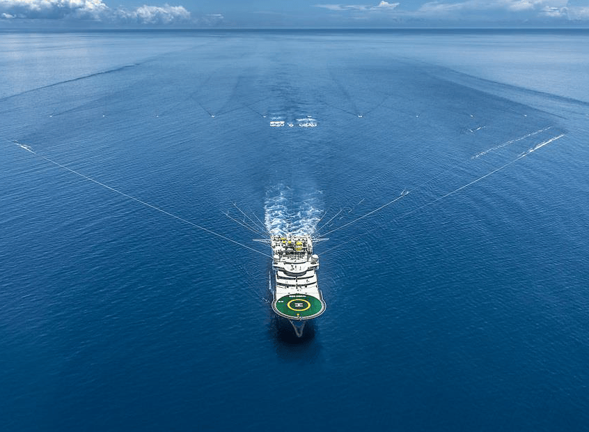
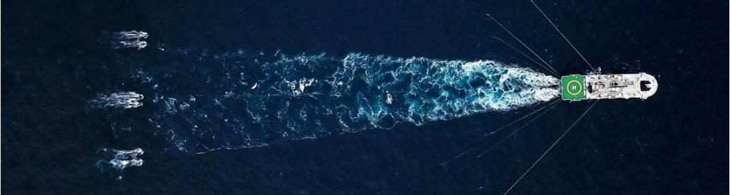
Magnetic and gravity data assist general planning, large scale basin-wide studies and prospect scale analysis, as an aid to interpreting complex geology. These data are acquired at ocean surface onboard various vessels, from large ocean-going ships in open ocean and continental shelf areas, to small shallow draft vessels in shallow seas or transition zones.
Xcalibur Smart Mapping has over 35 years of experience in safely collecting, processing, and interpreting state-of-the-art marine gravity and magnetic data worldwide.
The value of integrating multiple geophysical and geological datasets is at the core of the Xcalibur Smart Mapping philosophy. When this is combined with the efficiency of collecting gravity and magnetic data in conjunction with your seismic, it allows explorers to continue pushing the boundaries of discovery.
Marine Data Acquisition
Xcalibur Smart Mapping Marine usually collects state-of-the-art marine gravity and magnetic data on seismic vessels along with 2D, 3D, or OBN seismic surveys, but also can acquire these data as a standalone gravity and/or magnetic survey. or on vessels that are doing coring studies, performing bathymetric and other geotechnical surveys.
As a truly independent provider of marine potential field data, Multiphysics Marine has established a track record with all the major marine seismic players to provide valuable datasets ancillary to seismic data. Xcalibur Smart Mapping has extensive global experience working with multiple seismic contractors, with over 1.1 M line km of survey data acquired to date for all major energy companies and many other private and governmental clients.
Our modern acquisition systems and dedicated staff ensure effective acquisition of marine gravity and magnetic data along with seismic surveys. Our professional staff and state-of-the-art equipment will not compromise the seismic shoot, and we typically provide 100% productivity. All our marine gravity and magnetic surveys are subject to the INTEGRAV™ project management system. This keeps the client fully informed during all stages of the project, from survey planning to delivery of final products. Especially important during the data acquisition phase is the provision of snapshots for data quality verification.
Marine Data Processing
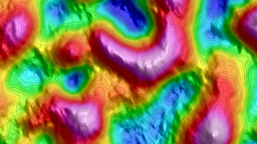
Besides collecting your marine gravity and magnetic data, Xcalibur Smart Mapping can also process and interpret these data for you using a collection of proprietary and commercial software packages.
The most important part of our processing services is our people. Our processing team in Houston is recognized worldwide as the leaders in high-quality marine data products. We are often called upon to process gravity and magnetic data by the largest independent and national oil companies in the world.