Natural Carbon Sink
The Importance of Reducing CO₂ Emissions to Mitigate Climate Change
Carbon dioxide (CO2) released into the atmosphere by human activities is a significant driver of global climate change and its far-reaching impacts, including rising sea levels, more frequent and intense extreme weather events, shifts in precipitation patterns, and disruptions to ecosystems and biodiversity. The most recent report from the IPCC (Intergovernmental Panel on Climate Change) indicates that a significant and enduring decrease in CO2 and other greenhouse gas emissions could mitigate the extent of climate change.
Efforts to reduce CO2 emissions drive the energy transition to renewable sources, improving energy efficiency and electrification, in the ambitious task of achieving net-zero. These efforts, however, must be complemented by solutions to decrease the concentration of atmospheric CO2, namely carbon capture and storage in geological formations (CCS) and preserving and enhancing natural sinks of CO2, such as forests, oceans, or soils.
Beyond the direct impact of these solutions in mitigating global climate change, actions to reduce CO2 emissions are rapidly becoming essential players in the future decarbonized economy where carbon offsetting and crediting, natural capital, and ecosystem services, play a pivotal role.
offers technologies and solutions aimed both at geological storage of CO2 and natural CO2 sinks.
CARBON SINKS AND THEIR ROLE IN CLIMATE CHANGE MITIGATION
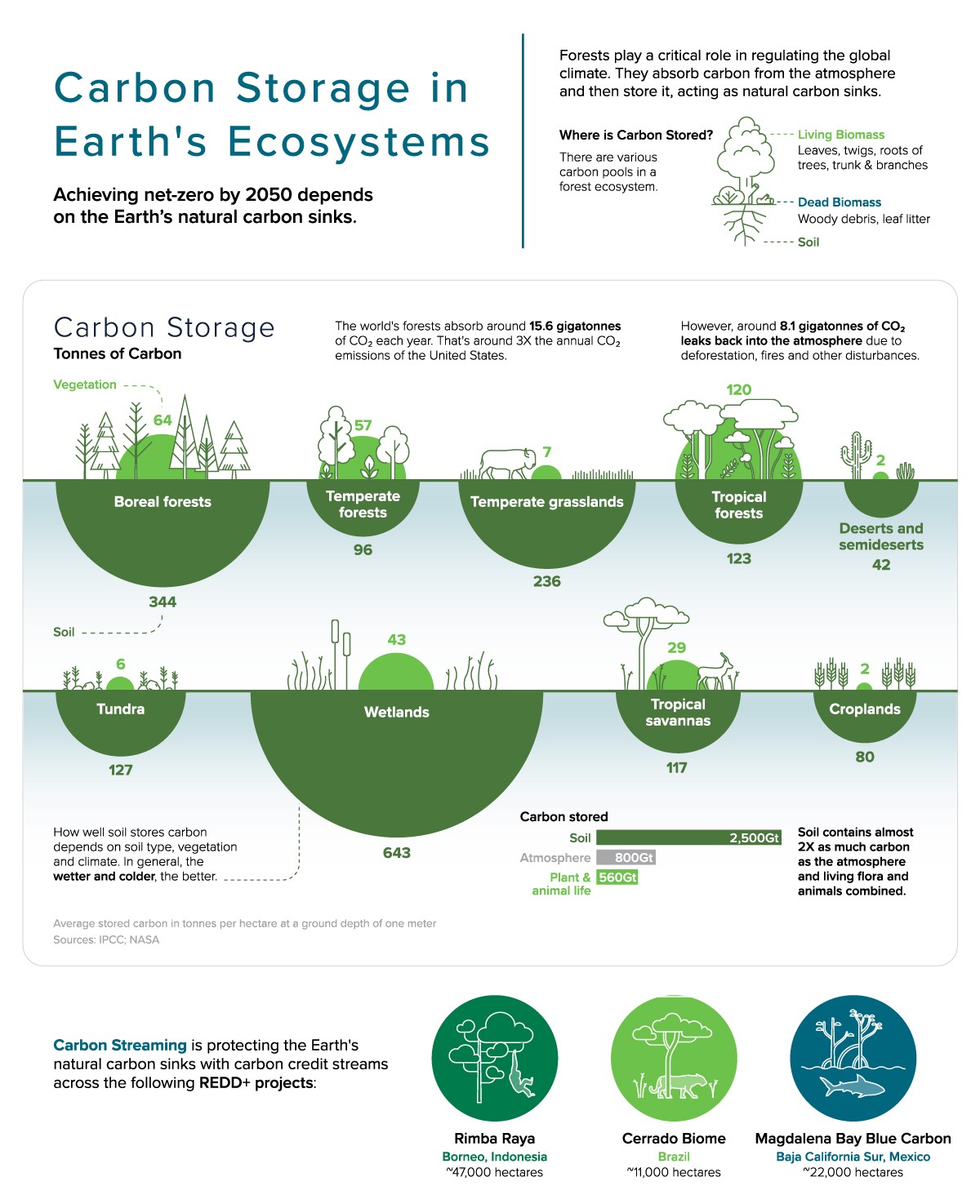
Carbon sinks are natural ecosystems that absorb more carbon dioxide (CO2) from the atmosphere than they release, therefore becoming an effective storage for CO2. Oceans are the largest natural reservoir for carbon storage, though when CO2 dissolves in seawater, the chemical reactions that take place led to an increase in the ocean’s acidity. Terrestrial carbon sinks also play significant roles in sequestering carbon and mitigating climate change, and include forests, soils, and wetlands. Unfortunately, many of these ecosystems are fragile and endangered by deforestation, land degradation or climate change (e.g. tropical forests, mangroves, marshes, or tundra).
Conserving and sustainably managing these ecosystems is fundamental in mitigating climate change and is a central pillar of the emissions trading market and other instruments which provide financial incentives for emissions reductions and investments in sustainable development projects. Ecosystem services valuation, forest inventory, carbon accounting and monitoring programs are at the forefront of land uses changes and forestry (LUCF) methodologies, used to estimate, measure, monitor and report on carbon stock changes and greenhouse gas emissions from LUCF activities.
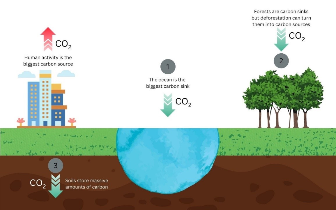
Plant biomass, including above ground (AGB) and below ground (BGB) parts, is the main conduit for CO2 removal from the atmosphere in terrestrial environments. Estimating biomass requires arduous field measurements that are impractical at large spatial scales where solutions require Earth observation and geospatial technologies.
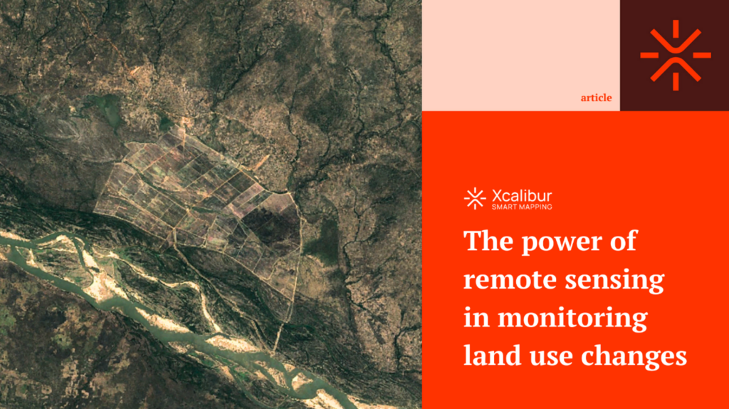
Xcalibur’s Geospatial Technologies group uses remote sensing data from active and passive sensors on satellites, aircraft and UAVs to analyse landscape metrics and spatial disturbance and assess land-use changes that affect carbon stocks (deforestation, afforestation, reforestation, etc.). A very relevant part is monitoring, verification and reporting (MRV) of LUCF.
Using advanced index-analyses, pattern recognition ML and structural parameters from remote sensing data, and advanced modelling schemes (e.g. SPV or RF-ML), we can provide indirect estimates of AGB across large spatial extents.
Natural Carbon Sink
Coming soon

